What We Do
Marine Intertidal Monitoring
The Marine Environmental Unit (MEU) has a long history of marine intertidal monitoring both on Orkney’s rocky and sandy shorelines. These monitoring programmes were first established with the creation of the MEU back in 1974 when the council required biological monitoring of intertidal areas within Scapa Flow to monitor for the effects of potential pollution from the Flotta Oil Terminal.
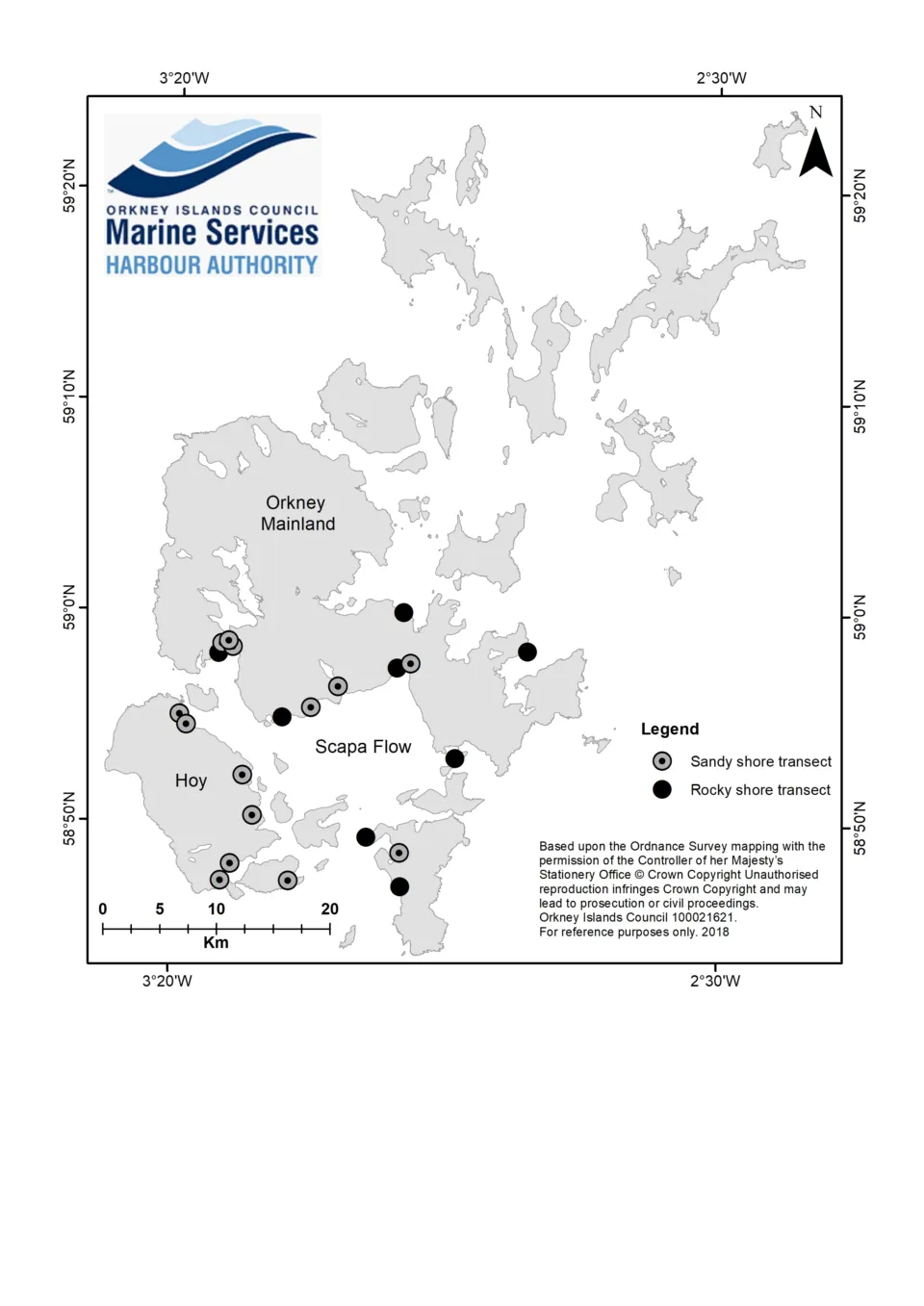
The long-term intertidal monitoring programme comprises of 13 sandy shore locations and 21 rocky shore sites that are situated across the Orkney Mainland as well as in the north and south isles.
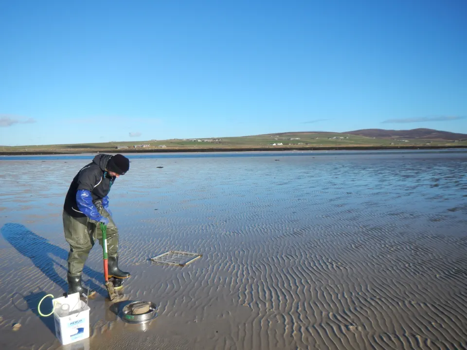
Sandy Shore Monitoring
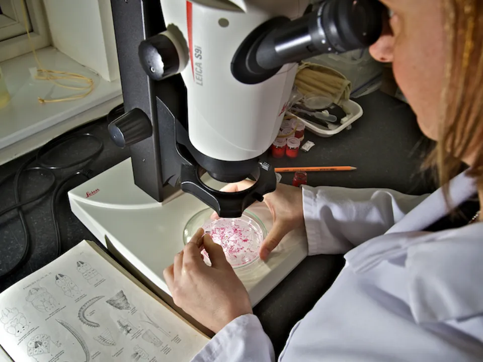
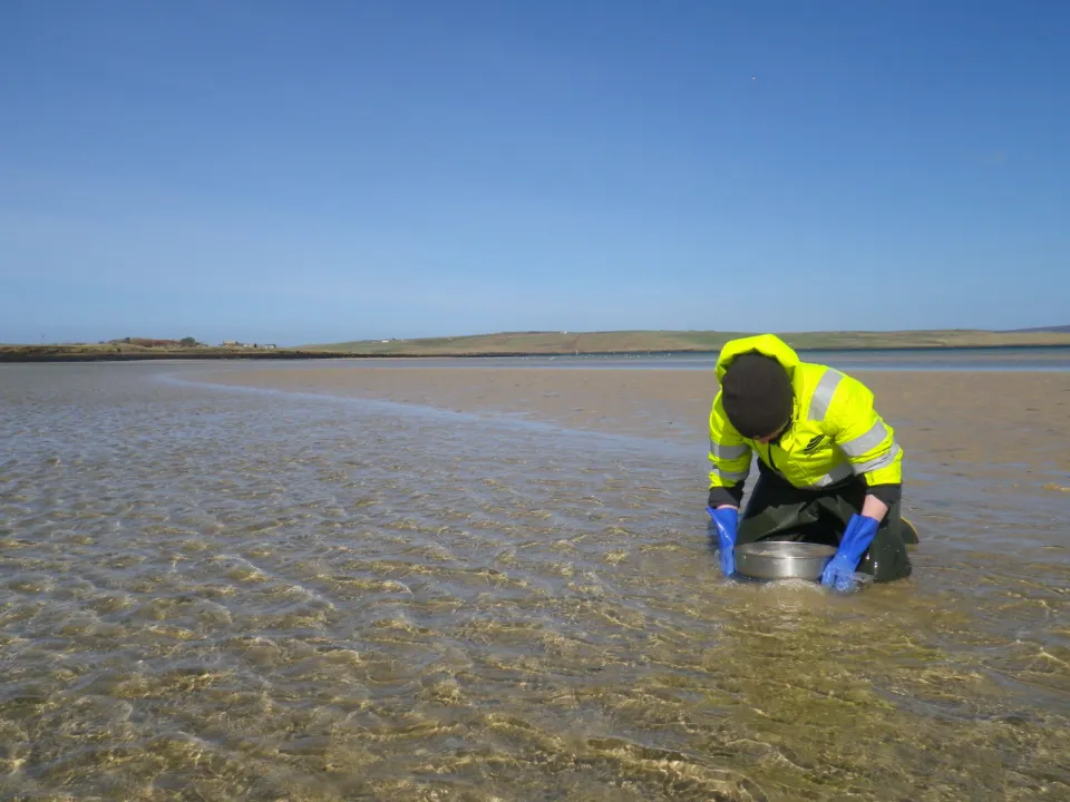
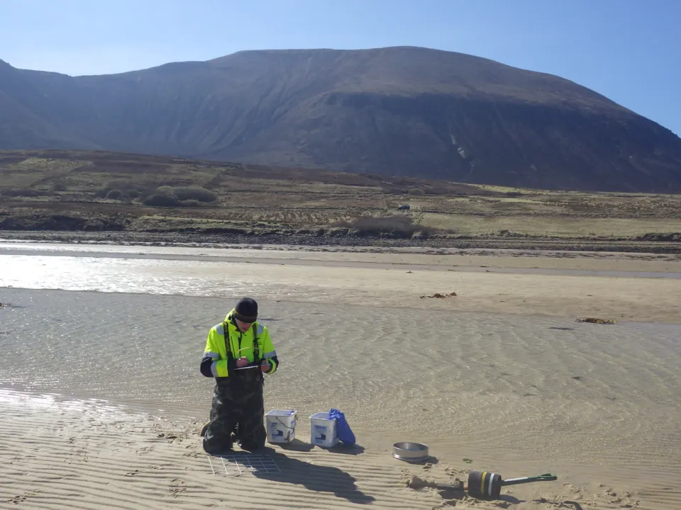
Each site has several stations at which benthic cores are taken within the top 10cm of the sediment. These are sieved and then preserved ready for in- house taxonomic identification whereby the data is used to explore benthic macroinvertebrate abundance and community composition.
Additional survey work includes:
- Sediment samples for granulometry
- Redox potential discontinuity: depth of boundary between aerobic and anoxic sediment
- Quadrats for estimates of mobile fauna abundance
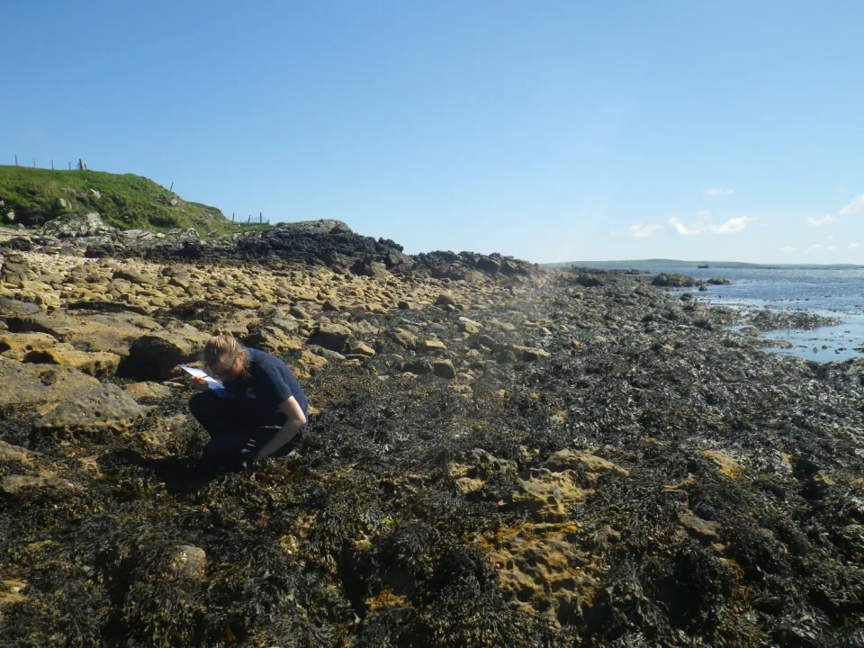
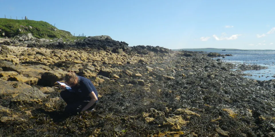
Rocky Shore Monitoring
In 2014 MEU aligned its rocky shore abundance survey's with that of the UK Marine Biodiversity and Climate Change (MarClim) programme. MarClim is a long-term rocky shore monitoring programme in the UK that assess and predict the influence of climate change using intertidal rocky shore biodiversity. Surveyors estimate abundances of species from the high, mid, and low shore, using a pre-defined list containing species found in marine intertidal habitats with the inclusion of non-native species and climate sensitive species.
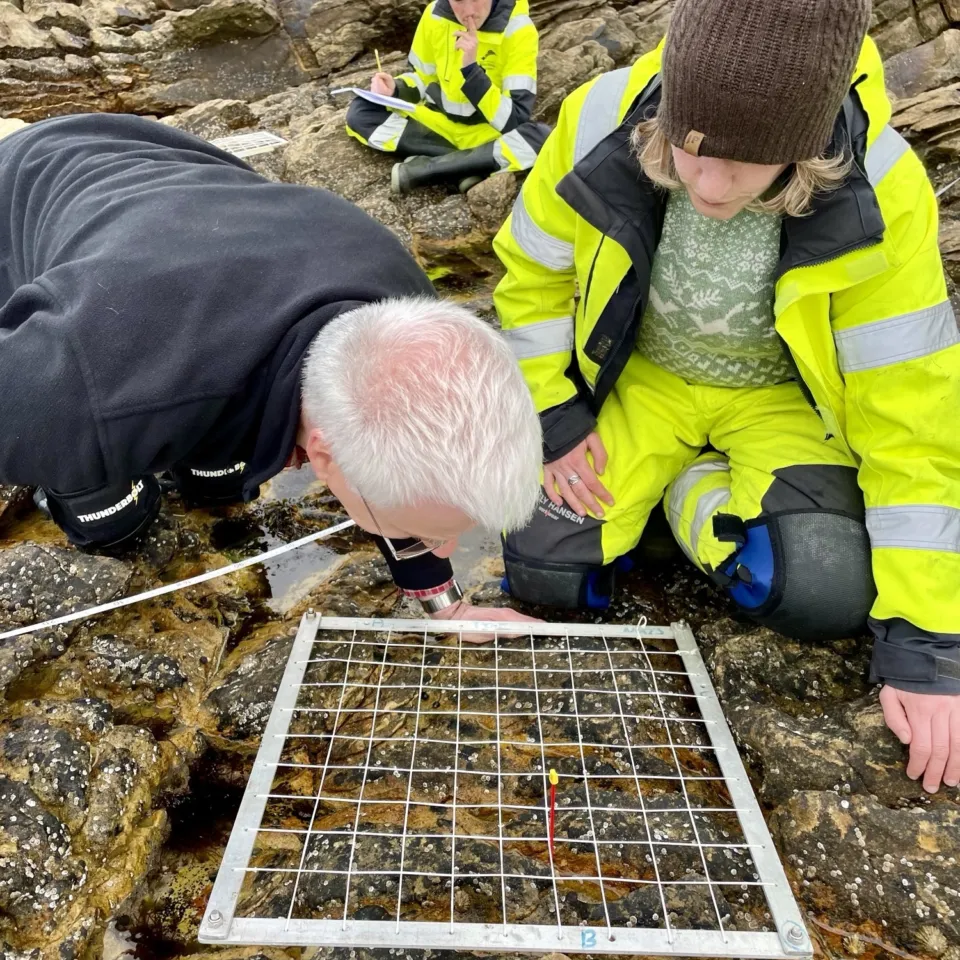
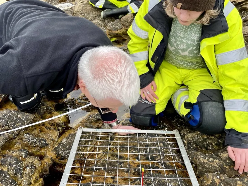
We also do fixed line transect surveys which provide more numerical data than the MarClim. Stations are set at fixed lengths along a piece of tape from the top to the bottom of the shore. Quadrats are then randomly thrown within each station with percentage cover of algae, encrusting animals and counts of mobile fauna taken.
Starting in 2023 a new rocky shore monitoring programme was set up to establish foremost a baseline understanding of the intertidal habitat and communities within the sites of the proposed developments of Scapa Deep-Water Quay in Scapa Flow and the extension of Hatston Pier in Kirkwall. The surveys use transects and MarClim type surveys and are done annually so that we can assess the effects before, during, and after the developments have been completed.